“It’s a hazardous hairpin curve that has a fatal crash history,” says Tom Strandberg, ODOT’s Region 5 Public Information Officer. “It can be a bit of challenge especially during winter.” A crashed truck lay at the bottom of the ravine as a grim reminder to slow down and pay extra attention. It was removed around the time the project started.
“The curve is located on the steep Minam Grade, which further complicates the maneuver drivers need to make,” adds Josh McCullough, ODOT’s Region 5 Senior Construction Specialist, who is serving as the assistant project manager on the project.
Although there are signs in the area, Strandberg notes the curve still catches some people off guard. That’s particularly true for tourists who use the route to go Wallowa Lake.
ODOT has been aware of the hazard but had to wait to begin the project until funding was available. In the meantime, ODOT has been correcting other curves and alignment issues along the Minam Grade.
Another issue with the curve is the fact that it’s a 25 mph curve while Wallowa Highway has a speed limit of 55 mph. “Upon completion of the project, it will be a 40 mph curve,” says Strandberg. “The curve will be more gradual and easier to maneuver around.” Besides realigning the curve, it will also be further away from the edge of the hillside.
A second aspect of the project is a slope and bank stabilization, and it’s taking place about 2 miles down the road from the Minam Curve. Over the years, this area has experienced erosion, bank failure, shoulder failure, and the existing guardrail has failed as well. The damaged area runs approximately 80 feet in length and extends 60 feet down from the roadway to the Minam River. The failure extends into the paved shoulder with a vertical drop of 5 to 8 feet.
For both the Minam Curve realignment and the bank stabilization, ODOT has kept the road open during construction. “While we were working, we set up a lane closure and pioneered the road,” says McCullough. “We excavated the embankment and built it up back to the road.”
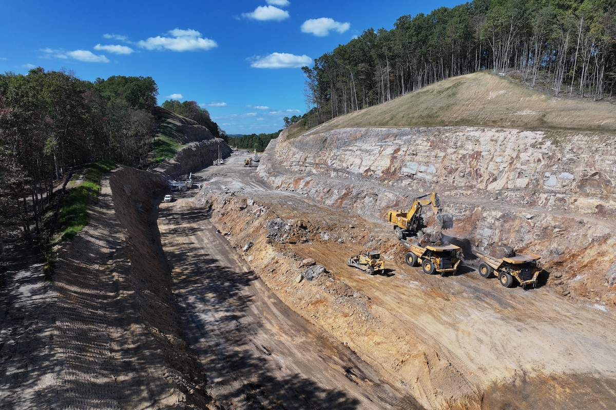
Removing materials for the curve realignment was a challenge. “The team blasted out and remove 250,000 cubic yards of rock and debris from the hillside,” McCullough says. “The mass hauling of this material was time consuming.”
As part of the project, the team set up a disposal area across the road. McCullough says, “We moved rock from one side of the road to the other, adjusting the downhill slope on the west side of the curve.” The team compacted the rock and placed it according to the model that they designed prior to beginning the job.
Due to the quantity of dirt and rock that had to be removed, the contractor used three drill rigs at a time, as well as large excavators, loaders, and haulers. “This type of equipment is typical of ODOT work,” McCullough says. However, “The uniqueness of this project was constructing the new alignment and the large quantity of the excavation.”
According to McCullough, the project has taken longer than the contractor anticipated and is slightly behind schedule. In an attempt to get back on track, the contractor switched to double shifts last summer. However, with fall comes shorter light hours, and the contractor had to return to single shifts.
While not a contributing factor for project delay, one unforeseen challenge was the discovery of a 150-foot pocket of clay within the rock face. The team brought in a subcontractor to design, build, and stabilize the area.
“It’s just another aspect of a big project like this,” McCullough says. “There are surprises that pop up and you have to figure out how to deal with them. It certainly makes the job more interesting.”
Although the pocket of clay didn’t delay the schedule, it did add about $375,000 to the cost. The construction budget for the project is $4.3 million, though ODOT estimated $6.7 million total, which includes construction as well as engineering and contingencies.
The community is excited to see this critical project completed. “People were aware that this project needed to be done,” says Strandberg. “They’re happy to see it constructed and are looking forward to the result.”


