

“Even when I was much younger, I always loved nature and wildlife,” he said. “My experience in the Army was as a combat engineer so, when I separated, someone suggested that I should pair up my two strengths – engineering and love of the environment – by doing wetlands mitigation. So here we are today with a crew of nearly 20, capabilities in stormwater management, living shorelines, streams – really anything having to do with wetlands – and some exciting work ahead.”
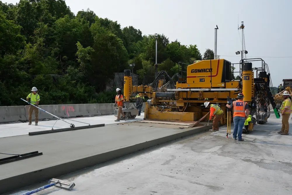
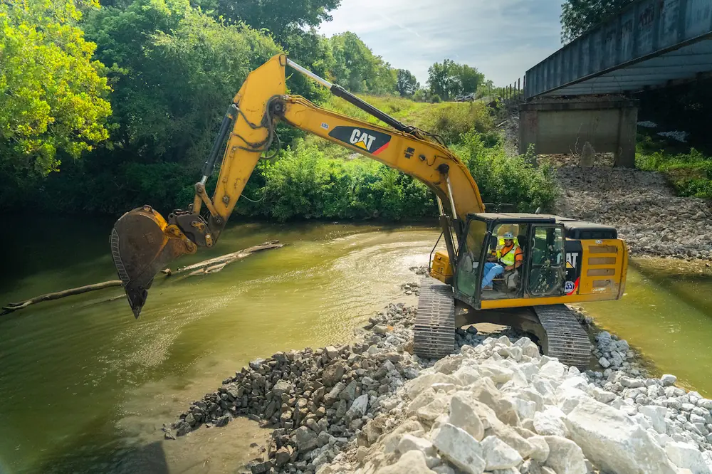
The work in which Perry and his team are currently involved, calls for the remediation of more than 3 miles of a Piney Run tributary near the village of Sykesville, Maryland. He said the project – being done for the State to earn credits under Clean Water Act provisions – is an effort to correct decades of stormwater mismanagement.
“As a company, the vast majority of the problems we see involve serious stream bed erosion, largely the result of development in the region,” he said. “Having all that impervious surface increases the likelihood of flash flooding, which yields massive amounts of sediment along with nutrients like phosphorus, nitrogen, etc. – all headed downstream and eventually to the Bay. Piney Run was a perfect example of that.”
“While at those sessions, some of the larger environmental remediation companies from North Carolina were singing the praises of GPS technology, raving about how much it sped up their production,” he said. “I thought the time had come give it a try, and having the Piney Run job coming up, it seemed that this would be the ideal opportunity to do so.”
With that in mind, Perry contacted the team at JESCO, Inc., the local Topcon dealer, from whom they’d been renting their machine, levels, etc. Although Bourn’s initial interest was in a dozer that featured GNSS-based machine control, the JESCO team felt it important to let Perry know of some other options available to enhance their operation.
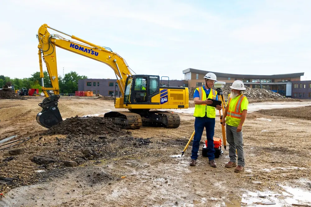
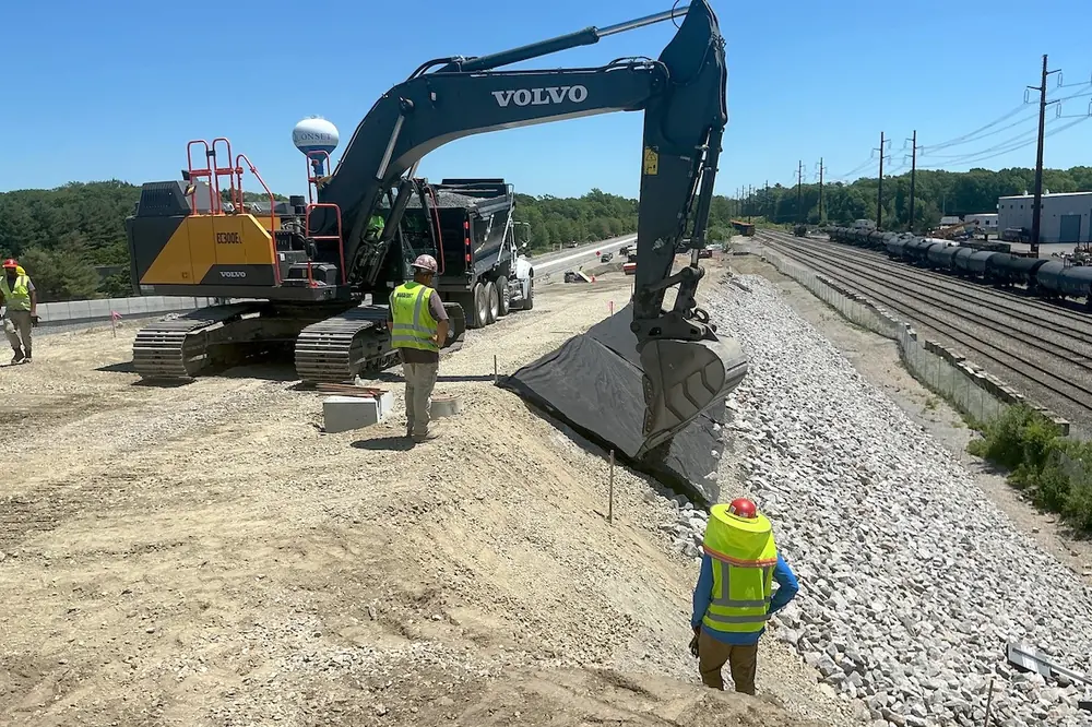
“We knew we wanted a dozer with machine control because of all the time we felt it could save us in doing our flood-plain work,” said Perry. “However, JESCO was great in starting the conversation about what GPS in an excavator could do for us. They brought a machine equipped with a Topcon X53i system out for us to demo and our guys loved it to the point of arguing over who got to use it. We placed our order for a second machine on the spot. Today, we have that same system on a pair of John Deere 245G Excavators and can’t imagine doing another project without it.”
After the delivery, according to Brett Howett, JESCO’s Territory Manager, his company gave Bourn their initial training on all the machine control systems and will follow up as needed and as they continue to become adept with it. “We’ve found that, most often, we give the customer the basics and as they start using it, their proficiency goes way up – and that’s definitely been the case with the Bourn team. Right now, their guys can probably run a rover better than any of us.”
“So, at Piney Run, we have literally buried the old channel and are carving a new one through the flood plain,” said Perry. “We’ve raised the stream bed and lowered the plain so that water can empty onto it more easily like it was meant to do. In addition, the project’s engineering firm has designed a series of structures throughout the course of the project that will affect the direction and velocity of the stream in different ways. Our excavator operators have really taken to the GPS in making those structures – which are made of either wood or imbricated stone – happen. If they are wood, they are massive logs or root wads; if they are stone, they can be anything from small aggregate, to huge boulders stacked atop each other. Regardless of the material, however, we have to maintain tolerances of .2 of a foot throughout the project.”
In the case of the larger boulders, which generally weigh 3 to 4 tons, the excavators must dig deep into the stream’s subbase so that the top of the structure can hold that grade and create a pool after it. Bourn’s operators used the strengths of the GNSS solution to make that part of the job fast and accurate.
“It’s hard to get huge boulders to stack perfectly and then try to do so in a circle for a step-pool, but still make it all look uniform,” said Steve Griffin, Bourn’s Foreman. “That’s why digging down to a specific grade for two different rocks each time allows us to keep a constant elevation on the top. Our operators would measure two rocks that stacked well on top of each other, subtract that from final grade on the system to get that number on the screen, and then simply dig to that subgrade. It’s fast and reliable and has worked out great.”
“We were 40 days behind schedule at one point and, after bringing the new equipment on board, reduced that by 25 days,” said Perry. “That’s an impressive amount of time to make up. We gained in so many areas, including efficiency in creating the new flood plain with the GPS dozer, as well as from the excavators streamlining the material movement and placement operation.”
That last point is echoed by Griffin who said that, unlike dry dirt work in which overcutting can be easily corrected with a scoop of material, doing so in a stream bed can be a messy affair.
“When excavating for a structure, if we overcut a half foot or so, we obviously have to put material back in,” he said. “But when that material is mud, it doesn’t support the log, it becomes a real struggle and production suffers. With GPS, there is no overcutting; the operator digs, hits the elevation he sees on the screen, puts the structure in and is done. It’s been amazing.”
Even the impact made by the rover – a Topcon HiPer V with FC-5000 controller – has been huge and contributed to Bourn’s stepped-up progress, according to Perry. “Being able to have any management-level person take that instrument, grab the structure table with our finished elevations and then just go out to spot check things is incredibly helpful. While its main use is in initially building the structures, we are really liking it from a quality control angle.”
“We feel we’ve gotten into this technology at a great time,” he said. “There are definitely other regional companies doing this type of work that are not using these solutions. It puzzles me why they’re not, but I’m grateful we made the switch when we did. The payback in efficiency is impressive alone. I can come onsite first thing in the morning and tell my operator, ‘Kory go up there and build that structure, I’ll be there in a bit,’ – and he has everything he needs. The materials are right there, he checks his grade, verifies it with a known elevation and just gets to work. Suddenly, the operator is one of the most productive people on the crew.”
It’s important to note that Bourn’s work window is subject to closures to accommodate trout spawning season – essentially shutting down the operation from October through May.
“That makes the improved performance we’re getting all the more appreciated,” said Perry. “And the trout concern is really another aspect of what we are trying to do here. Once all these improvements are in place, it’s hoped that greater numbers of trout will once again find it a suitable spawning area. Most of the guys on my crew are fishermen, so they feel a real connection to the work we are doing here. In fact, there is a huge gain for a wildlife overall from this remediation. In heavy rains, that flood plain we are working on will be a massive wetlands all year long and serve as a great area for waterfowl. So yes, when we are done, the new design will hold back nutrients and sediment, but it is also doing a whole lot of other good. And we’re proud to be making it happen.”
Bourn has wrapped up the first 6,000 feet of the Piney Run restoration and the company is currently mobilizing for another stream restoration project in Montgomery County that will utilize the same GNSS solution.