Reed & Reed, Inc. of Woolwich, Maine, is the general contractor for the $61.2 million project, working with the New Hampshire Department of Transportation (NHDOT) and the Vermont Agency of Transportation (VTrans).
NHDOT is the lead owner of the project that will replace two historic, 102-year-old, steel truss bridges; the Anna Marsh Bridge and the Charles Dana Bridge – both constructed in 1920. The historic structures will remain in place and be restored for pedestrian traffic under a different contract.
According to Project Manager Dustin Littlefield, Reed & Reed is a little over a year into the three-year project that has a completion date of October 25, 2024.
According to a NHDOT report, the Anna Marsh Bridge is a fracture-critical Parker Truss with a span length of 324 feet and is in poor condition The bridge is posted for a minimum vertical clearance of 11 feet, 4 inches, which is well below the minimum required vertical clearance of 16 feet, 6 inches.
The Charles Dana Bridge is also in poor condition and has a total length of 297 feet – consisting of a 200-foot span fracture-critical Parker Truss and two steel girder approach spans. The bridge is posted for a minimum vertical clearance of 11 feet, 10 inches, also well below the minimum required vertical clearance noted above.
Both bridges have a roadway width of 20 feet, 4 inches (two 10-foot-2-inch travel lanes and no shoulders) and both bridge sidewalk configurations include 6-foot cantilevered sidewalks outside the upstream trusses.
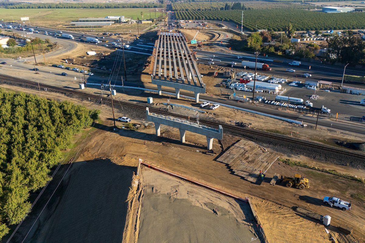
“The new bridge is being constructed off alignment, approximately 1,000 feet downstream from the existing bridge and will form a new T-intersection on Vermont Route 142 just south of Brattleboro’s ‘Malfunction Junction’,” Littlefield said. “The new alignment will reduce congestion for the now five-leg intersection in the busy downtown area and cross over the New England Central Railroad (NECR) used for freight and Amtrak train services.”
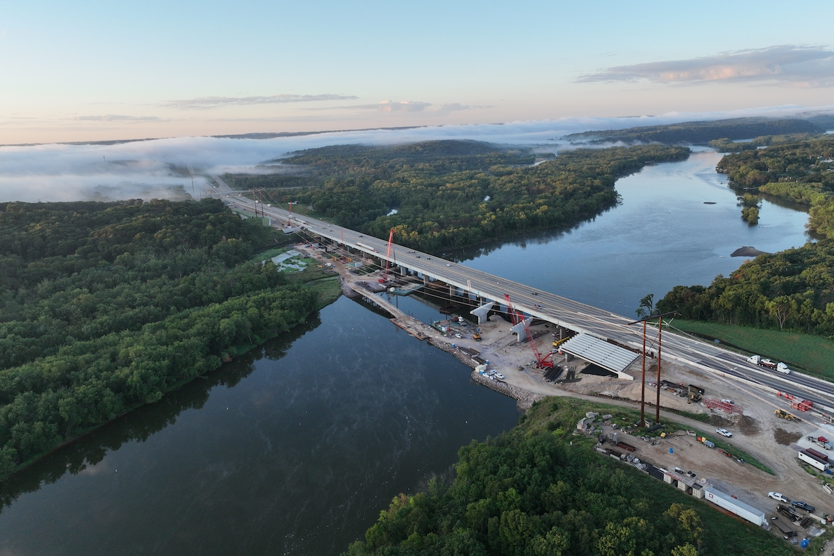
The project includes bypassing the existing historic truss bridges with a new concrete deck and steel girder bridge. The new bridge will be a 1,798-foot-long, 8-span, curved steel girder structure with a typical section of two 12-foot travel lanes, two 8-foot shoulders, and one 6-foot sidewalk, for an out-to-out width of 49 feet for most of the bridge, flaring to 58 feet at the Vermont intersection. The vertical clearance over the mean water level will be 45 to 50 feet.
“Work began on the New Hampshire side of the river where Abutment B and Pier 7 are located,” Littlefield said. “The other piers are in descending order to the Vermont side of the river where Pier 2 is the last river pier and Pier 1 landside in the middle of Barrows & Fisher’s fuel oil terminal. New approaches on both ends of the bridge will be constructed to provide for a better flow of traffic, avoiding a very busy, multi-approach intersection in Vermont. To perform the in-water work, we have constructed a temporary work trestle some 1,300 feet long that extends from the New Hampshire shoreline to Pier 2. The trestle allows work on the piers, structural steel erection and bridge deck construction. Just prior to final completion of the bridge, we will remove the trestle and make final adjustments to the adjacent areas.”
As of February 2023, work was well underway for the new eight span bridge. The New Hampshire abutment and three of the seven piers are complete, and two additional piers and the Vermont abutment are in various stages of construction.
The substructure includes six in-water piers and one landside pier. The piers are constructed inside sheet pile cofferdams, with excavation depths ranging from 2 feet to 18 feet below the riverbed for the concrete seal. The pier foundations bear on 12 to 15 each – 30-inch diameter by 1-inch walls, open bottom steel pipe pile. All piles are battered 6:1 with exception of center piles in each foundation. The pipe piles are driven to bedrock, up to 160 feet in length, before being encased in a concrete seal and pier footer. The pipe piles are cleaned out to 80 feet below cut off elevation and filled with a reinforcing cage and concrete.
The structural steel superstructure is comprised of five girder lines, with haunched pier girders, and a horizontal curve for half the bridge.
“Another of the many challenges will be erecting the nearly 100,000-pound curved girders, while maintaining construction activities to the remaining pier work,” Littlefield said. “The project permits did not allow access from the Vermont shoreline, so all work must be completed from the temporary work trestle or by barge – a logistical feat in itself.”
Deck construction in Vermont will consist of a conventional full depth cast in place (CIP) deck while the New Hampshire portion will have a CIP deck on precast panels. The wearing surface will consist of concrete wearing surface on Vermont side of the bridge and an asphalt wearing surface in New Hampshire.
The 1,800-foot Vermont approach includes a new T-intersection onto Vermont Route 142. Regrading of the existing Vernon Street is required to accommodate the new, higher bridge approach. The Vernon Street upgrade includes a Mechanically Stabilized Earth (MSE) retaining wall, new drainage and water lines and relocation of existing overhead electrical transmission, distribution, and broadband lines to new underground facilities.
In New Hampshire, the reconfigured 1,100-foot approach includes re-worked intersections for Mountain Road and Georges Field Road. The approach also provides a new sidewalk, upgraded drainage and relocated overhead power and communication lines.
Although pedestrians and bicyclists will still be able to use the rehabilitated historic truss bridges, the new bridge will provide a substantial safety improvement for operators of vehicles, pedestrians, bicyclists, and train operators.
In addition to the new bridge, the contract includes a new boat launch for Hinsdale, New Hampshire. The new precast boat ramp and upgraded parking area replaces an existing dirt launch with challenging access – a great improvement to access for recreational boating along the Connecticut River.


