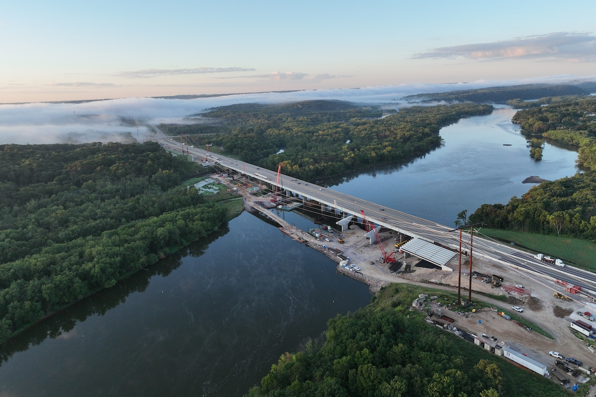
On track to be completed next summer, I-10 Connect will provide travelers with more direct access to the international crossing as well as enhance mobility across the busy roadway network.
I-10 Connect is necessary because El Paso needs a direct connection to facilitate travel between I-10 and Loop 375. At present, motorists are forced to utilize I-110, U.S. 62, U.S. 54, and various city streets to complete their journeys.
To access BOTA from I-10, traffic currently exits southbound onto I-110, and many drivers choose to access the port of entry via U.S. 62. The existing configuration of I-110 in this area is problematic because it causes major slowdowns during peak periods of travel, resulting in spillbacks to U.S. 54 and the I-10 connector ramps. In recent years, traffic queuing has adversely affected the quality of life for those living in the area surrounding the iconic Chamizal National Memorial. However, with the I-10 Connect project, ramps from U.S. 62 to I-110 and BOTA will be removed during the interchange reconstruction, which will prevent traffic from backing up into residential neighborhoods.
Besides keeping commuters and commercial trucks off local roadways, I-10 Connect will provide an alternate route to I-10 – a vital improvement in a place where geographic constraints paired with the border city’s proximity to Mexico create significant mobility challenges.
TxDOT Public Information Officer Jennifer Wright comments, “If you look at roadway networks in Houston, San Antonio, Dallas, or Fort Worth, you see that they have loop within loop within loop and all these alternate routes because they’re just flat areas with room for connectivity options. In El Paso, however, there is a mountain that runs right through the middle of the city, and we have an international border and a state border, so we don’t have that type of loop scenario. Everything gets pinched down at the foot of the mountain. It’s not easy to just go another way; alternate routes just don’t exist here like they do in other communities.”
For the TxDOT El Paso District, which oversees both urban and rural transportation needs across a 21,700-square-mile region, this strategic project is key to minimizing negative traveling impacts, both now and in the future when plans to upgrade I-10 in El Paso’s downtown, central, and east areas eventually come to fruition.
“This project adds much-needed connectivity for incident management and for a potential upcoming project called Downtown 10, through which we plan to rehabilitate the downtown I-10 corridor,” Wright explains. “I-10 was built in the 1960s originally and the reinforced concrete pavement is now reaching the end of its useful life; it’s a patchwork of pothole repair at this point.”
“We need I-10 Connect in order to build this other project,” adds TxDOT Project Manager Jorge Oregel. “We’re going to have to shut down I-10 and the alternate route will be Loop 375, so we need a direct connection to Loop 375.”
Wright shares that Downtown 10 is currently in preliminary environmental review stages, with an estimated $800 million price tag. “This project would require the reconstruction of several bridges downtown and the roadway, plus the addition of frontage roads for incident management purposes. We expect the environmental process to take at least a couple of years, and two to three years for design. I think the earliest we could see something under construction would be 2024-2025,” she says.
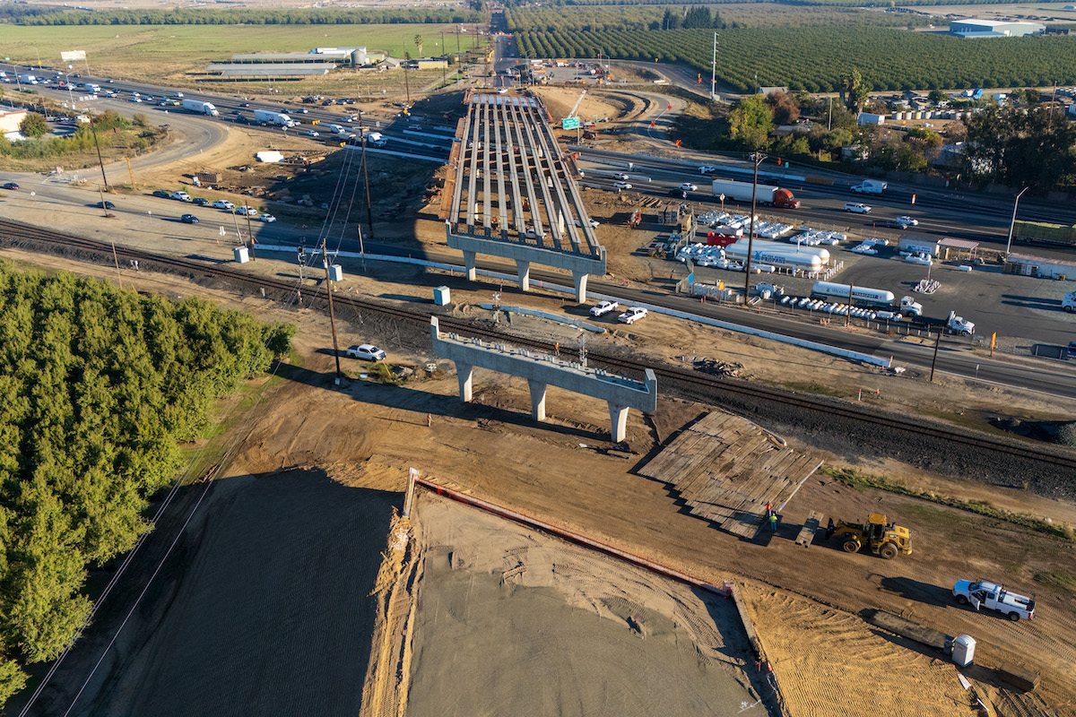
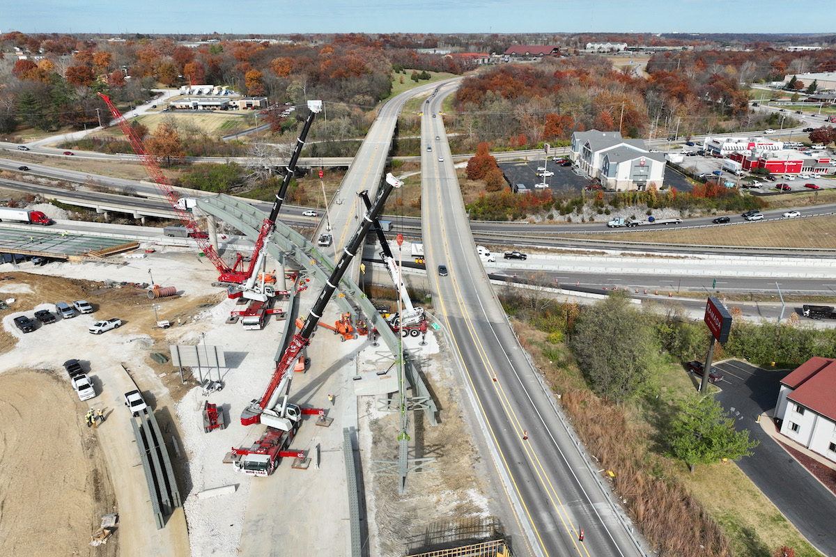
Four new direct-connector ramps will link I-10 and Loop 375. The new flyover from southbound U.S. 54 to southbound I-110 is one of the most visible project components, soaring more than 75 feet above the roadway surface to provide motorists with direct access to BOTA. Another ramp from westbound Loop 375 to northbound U.S. 54 will provide access to I-10, and one from eastbound I-10 will connect to southbound U.S. 54 and from Loop 375 and I-110 to BOTA. The direct connector from westbound I-10 will ferry traffic coming from southbound U.S. 54, Loop 375, and I-110 to BOTA.
The reconfigured interchange previously described includes enhanced pedestrian facilities and improved accessibility for the Findley Avenue community. Access from Stevens Street to I-110 and the U.S. 62 interchange are also being removed, which is intended to relieve traffic congestion associated with the port of entry on local surface streets.
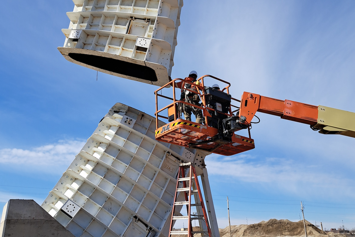
According to Rudy Elias, Senior Project Manager for Sundt Construction, the entire project will require approximately 263,000 man-hours. Projected material estimates include 350,710 square feet of reinforced concrete bridge deck, 145,270 cubic yards of earthwork, 67,520 cubic yards of concrete paving, 18,350 tons of asphalt pavement, and 34,920 square feet of retaining walls – including 5,380 square feet of mechanically stabilized earth (MSE) structures. Crews are removing 12 existing bridges and constructing 16 new bridges designed to have a minimum 50-year life span, says Enrique Roldan of CONSOR Engineering.
Workers are also installing various intelligent traffic system (ITS) elements, including additional dynamic message boards and changeable overhead lane markers, to enhance traffic flow through the busy area, which averages almost 200,000 vehicles each day.
Bridge construction and demolition are occurring across all project phases, and the majority of roadway widening and paving activities will take place during the final phase. Phase one is anticipated to wrap up next month, which includes finalizing work on four new bridges and completing the direct connector between westbound I-10 and U.S. 54 leading to BOTA.
While certain intermittent and long-term roadway closures have been necessary, Elias confirms the project team has taken proactive steps to minimize construction impacts on the traveling public. Overnight bridge work, for instance, has helped to keep traffic flowing more smoothly during peak daytime hours. Roldan adds that improved traffic control solutions have delivered major benefits to drivers, and shares a couple of case-in-point examples. “At Pershing Drive and Trowbridge Drive, TxDOT made some major improvements at the turnarounds to facilitate the free flow of commuters and freight trucks through those intersections and detours with no stopping. There’s also a free flow at the I-10 and Trowbridge intersection and at U.S. 54 and Pershing,” he says.
TxDOT is using trailblazing signs marked with the project’s signature emblem along detour routes. According to Oregel, this is the first time the El Paso District has implemented such an approach to ease navigation through the area’s various construction zones. Smart Work Zone technology has also been deployed to provide real-time traffic and detour information to drivers.
Along with local commuter traffic, this project naturally had great impact on transcontinental and international travel in the El Paso-Juárez region. In light of the economic importance of cross-border trade, TxDOT undertook a robust multiplatform, bilingual, binational approach to ongoing construction communications. In addition to regular news releases, email blasts, and bilingual social media videos, the communications strategy includes a bilingual project hotline, bilingual text message alerts that are delivered in advance of major traffic impacts, and monthly community meetings to apprise the public of project updates and address questions. In recent months, these meetings were held virtually to meet social distancing guidelines set forth by the Centers for Disease Control and Prevention in response to the COVID-19 pandemic.
“While electronic communications tools are great, nothing can supplant face-to-face dialogue,” adds Marina Monsisvais with Barracuda Public Relations. “The project team has established important relationships with regional cross-border trade groups, U.S. Customs and Border Protection, and the City of El Paso’s International Bridges Department to ensure that freight companies and operations of all international bridges in the region are vested in the project and equipped with information to make critical logistical decisions early.”
At one point, TxDOT intended to demolish the Lincoln Center to create a connecting path between I-10 and Loop 375. However, plans changed when community stakeholders decried losing such a treasured piece of Chicano heritage. The Lincoln Park Conservation Committee (LPCC) has been one of the most outspoken groups advocating to save the beloved structure from razing.
After listening to the concerns of LPCC representatives and other community members, TxDOT altered its original bridge designs in order to preserve the Lincoln Center, which will be available for lease once the highway project is completed.
Five bridge columns bearing murals will also stay intact, bearing resemblance to Stonehenge as monuments of cultural significance. The park’s first mural, Virgen de Guadalupe, is one that will remain as a memorial to El Calvario Catholic Church, which once stood at that location. Furthermore, the 10 mural-bearing columns requiring removal are being visually recorded, giving artists the potential opportunity to recreate the scenes on one of the new bridge columns that TxDOT is reserving for public artistry.
“It has been a challenge to work around the columns that TxDOT promised to preserve,” Wright says. “In some cases, the caps are being removed and the columns remain, and in others the entire caps and columns stay. There have been some unexpected twists and turns where we thought we could just demolish the beams above, but instead the contractor has had to lift them off with a crane, which has added some expense to the project. The process has required considerable communication and collaboration between project team members and community leaders and stakeholders. However, it’s all worthwhile as TxDOT demonstrates its commitment to serving the needs of the traveling public while preserving the character of the community as best as possible.”


