“Separation from the railroad tracks was a huge safety issue,” says James Unruh, Project Manager and Design Consultant with HDR in Sioux Falls.
Vehicular or train traffic could interfere with emergency vehicles, since only a few east-west roads in the city cross I-229 and the Big Sioux River, adds Dena Knutson, Civil Engineer and Project Manager for Sioux Falls. Winter weather increased the safety risks.
As many as 28,000 vehicles travel daily on 26th Street and 12,000 on Southeastern Avenue. Trains pass through the area three or four times daily. Both the 26th Street improvement and the Southeastern Avenue upgrades were less than 1 mile in length. The roads are two lanes in each direction, with new turn lanes.
Additionally, the I-229 interchange, built in 1970, was not up to current standards. As the area increased in population, it became strained with drivers experiencing long delays. The South Dakota Department of Transportation (SDDOT) and Sioux Falls hired HDR in 2011 to study the corridor. From 2011 to 2018, HDR, the city and state sought public feedback.
“The footwork to get us to construction was exceptional,” Knutson says. “There was so much public input and so many design options and tweaks and changes.”
Planning for the current project dates back to 2001, when a study prepared by the City of Sioux Falls recommended that at-grade arterial street crossings of the BNSF railroad tracks be converted to overpass crossings, he explains. The city acted on the recommendations, adopted a railroad overpass policy and has eliminated a couple of crossings, with others in planning.
A major challenge that emerged at 26th Street was access to Rotary Park, whose entrance would be severed by a railroad overpass bridge, Unruh explains. The city came up with alternatives and, ultimately, developed a new park on land already owned by the city.
“The impact to Rotary Park ended up as the most significant environmental concern or impact,” Unruh says. “Resolution required construction of a new Rotary Park on the opposite side of the Big Sioux River as the existing park. The construction of the park had to be completed before the vehicular access to the old park was eliminated. That meant construction of the new Rotary Park in 2018. The cost of the new park was approximately $2 million in addition to the road and bridge work.” The park features a picnic shelter, canoe launch, playground equipment, restroom facilities, and a new pedestrian bridge across the Big Sioux River to connect the new park with the old park and the heavily utilized bike path.
The project is a collaboration between SDDOT, which owns the interstate interchange, and the city of Sioux Falls, which owns the rest. SDDOT is administrating both projects, says Jared Pfaff, Project Manager for SDDOT.
SDDOT will own the newly designed interchange with I-229, and the city will own the park, the bridge over the Big Sioux River and railroad tracks, and 26th Street and Southeastern Avenue improvements. With adjacent projects planned, Pfaff says, “it’s always better to coordinate for sequencing.”
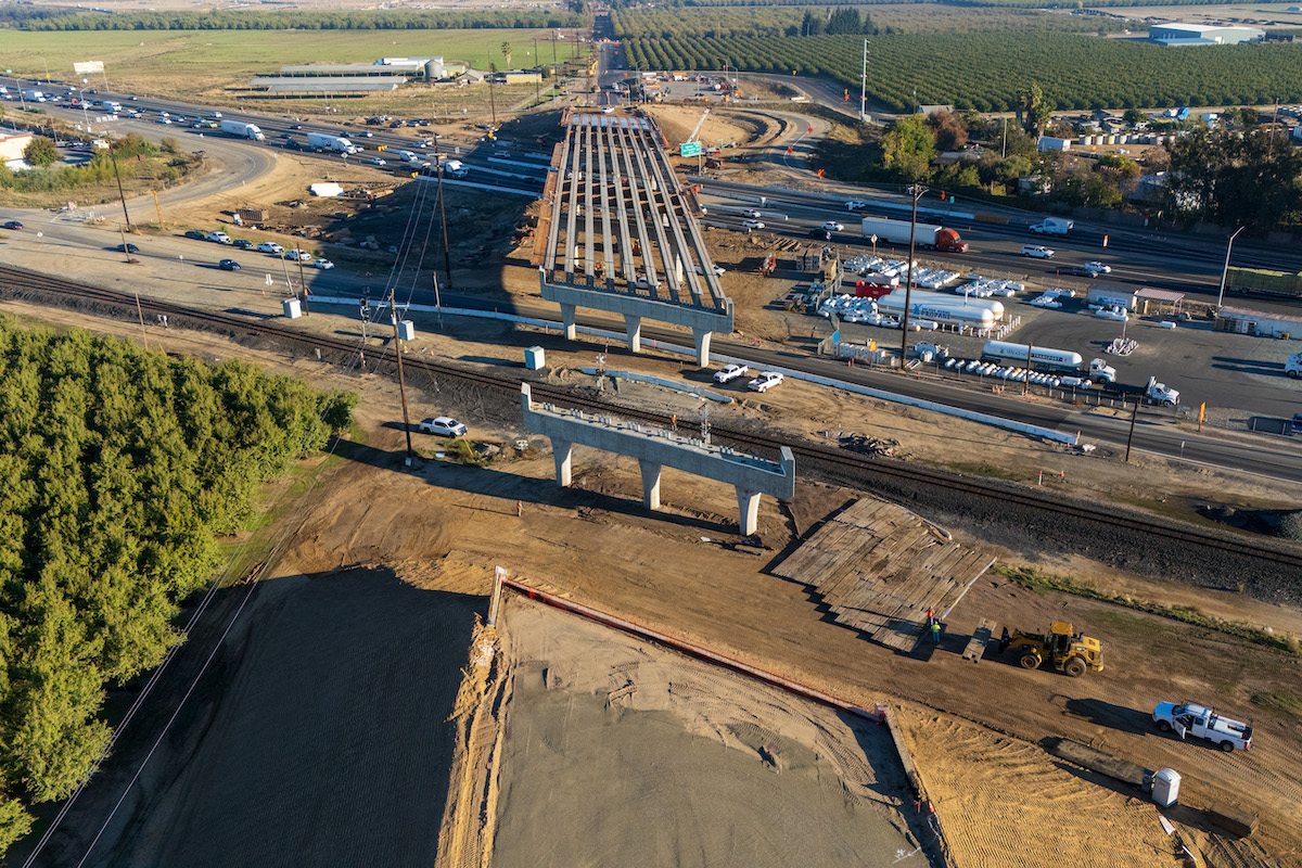
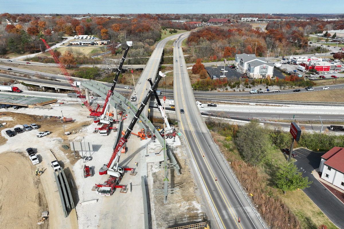
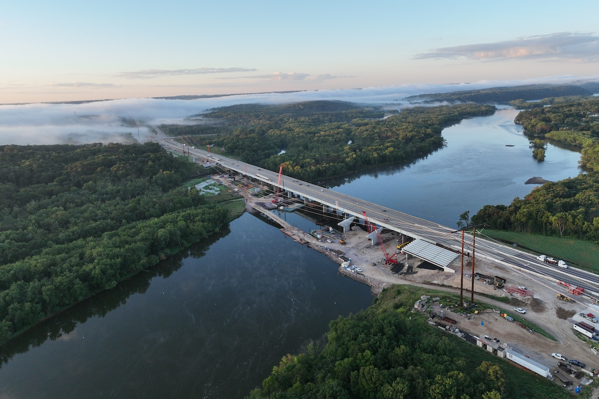
The work includes a new configuration for the I-229 ramps on the west side of I-229; reconstruction of 26th Street to include two or three through traffic lanes in each direction with right- and left-turning lanes; a new 650-foot-long, 95-foot-wide 26th Street bridge over the Big Sioux River and the BNSF railroad tracks; and an elevated and expanded 26th Street/Southeastern Avenue intersection that will end up about 30 feet higher than the previous intersection, Unruh explains.
“Even though the 2012 to 2018 planning, environmental process and design timeframe seems extensive, we were able to meet the project schedule milestones,” Unruh says. “This is a very important part of building and keeping the confidence and trust of the public.”
“They’ve always done an excellent job,” Knutson says. “They’re great at running projects and great to work with. It’s been a team effort.”
Construction of the reinforced-concrete girder bridge, crossing the Big Sioux River, was undertaken from both shorelines. No marine operation was needed. Both spread footing foundations on bedrock and steel pile foundations support the bridge.
The south half of the new bridge, the eastbound lanes, was completed in June 2020 and are open to traffic.
“The north half of the new bridge is under construction and will, hopefully, open to traffic by the end of 2020 depending on weather conditions,” Unruh says. “It is possible that opening of the north bridge to traffic could be delayed until 2021.”
Throughout the construction, lane closures have been kept to a minimum.
“At the insistence of business owners along the 26th Street corridor, we maintained one lane of 26th Street traffic in each direction through the construction zone for the duration of the project,” Unruh says. “This added up to $2 million to the project cost for temporary retaining walls and construction phasing of the bridge.”
On Southeastern Avenue, the intersection with 26th Street was closed with parallel arterial streets designated as detour routes, Unruh reported.
Traffic on the interstate was maintained throughout the project, while a ramp was temporarily closed last year.
“There was a lot of sequencing involved within every phase, between the MSE retaining walls and the bridge,” Pfaff says. “It’s important to keep traffic flowing through that corridor.”
During construction, surveying and staking used the models developed by HDR during design. D&G used GPS-based survey equipment.
“This project will be there for 75 or 100 years, a long-term improvement,” Unruh says. “It’s been a privilege for the team to work on something this significant and dramatic.”


